
Search Salina Streets by Address
For a street-by-street question, use a five-part trail rather than assuming one screen lists every resident. The Onondaga County Go2Gov property search is the practical first stop because Salina assessment data can be searched by property address, owner name, mailing address, or tax-map number. It identifies a parcel and a recorded owner, not a complete household. From there, the Onondaga County GIS viewer gives the map context, while the County Clerk index and library materials can supply the next records layer.
- Enter the street name in Go2Gov, adding a number when it is known. Save the property location, tax-map parcel, owner field, tax description, and roll date.
- Find that parcel in the GIS viewer. Zoom out, inspect the nearby parcels, and keep the parcel identifier with every map observation.
- Search the owner as a grantee in the Cott land-record index. The latest recorded deed can identify the seller and legal description for the next title step.
- Use the New York voter lookup only for a known person with the requested identity prompts. It is not a public list of a whole street.
- For an older printed address, ask OCPL Central Local History and Genealogy for the relevant city-directory or telephone-book year.
Each stop answers a different question. The parcel establishes an address key, the deed index follows title, the voter tool checks registration information for one person, and historical directories preserve dated printed entries. That division keeps a Salina street directory search from turning an owner field into an unsupported claim about every person at a location.
Salina Street Directory Property Fields
Go2Gov offers four advertised routes: Tax Map Number, Owner Name, Property Address, and Mailing Address. In the captured property and mailing forms, Street # is optional and Street Name is required. Owner mode requires a last name, with first and middle names available to narrow a result. Partial names are accepted. Town assessors supply the information, and the portal warns that updates are not final until the final roll around July 1, so save the access date with a Salina street directory result.
| Go2Gov field or mode | Form type | Required | Use in an address search |
|---|---|---|---|
| Tax Map Number | Advertised mode | Layout not captured | Parcel-based route when a street search fails |
| Last Name | Text | Yes in owner mode | Recorded owner-name search; partial names accepted |
| First Name / Middle Name | Text | No | Optional owner-name narrowing fields |
| Street # | Text | No | Number portion in property or mailing mode |
| Street Name | Text | Yes | Physical-property or owner-address street, depending on mode |
| Assessment Search | Link | Not applicable | Opens the SDG Image Mate assessment route |
Go2Gov's property search displays the available search modes before a result is selected. The screenshot below shows that starting point. It is useful for choosing the correct key, but a returned owner address still needs to be read as the roll labels it.
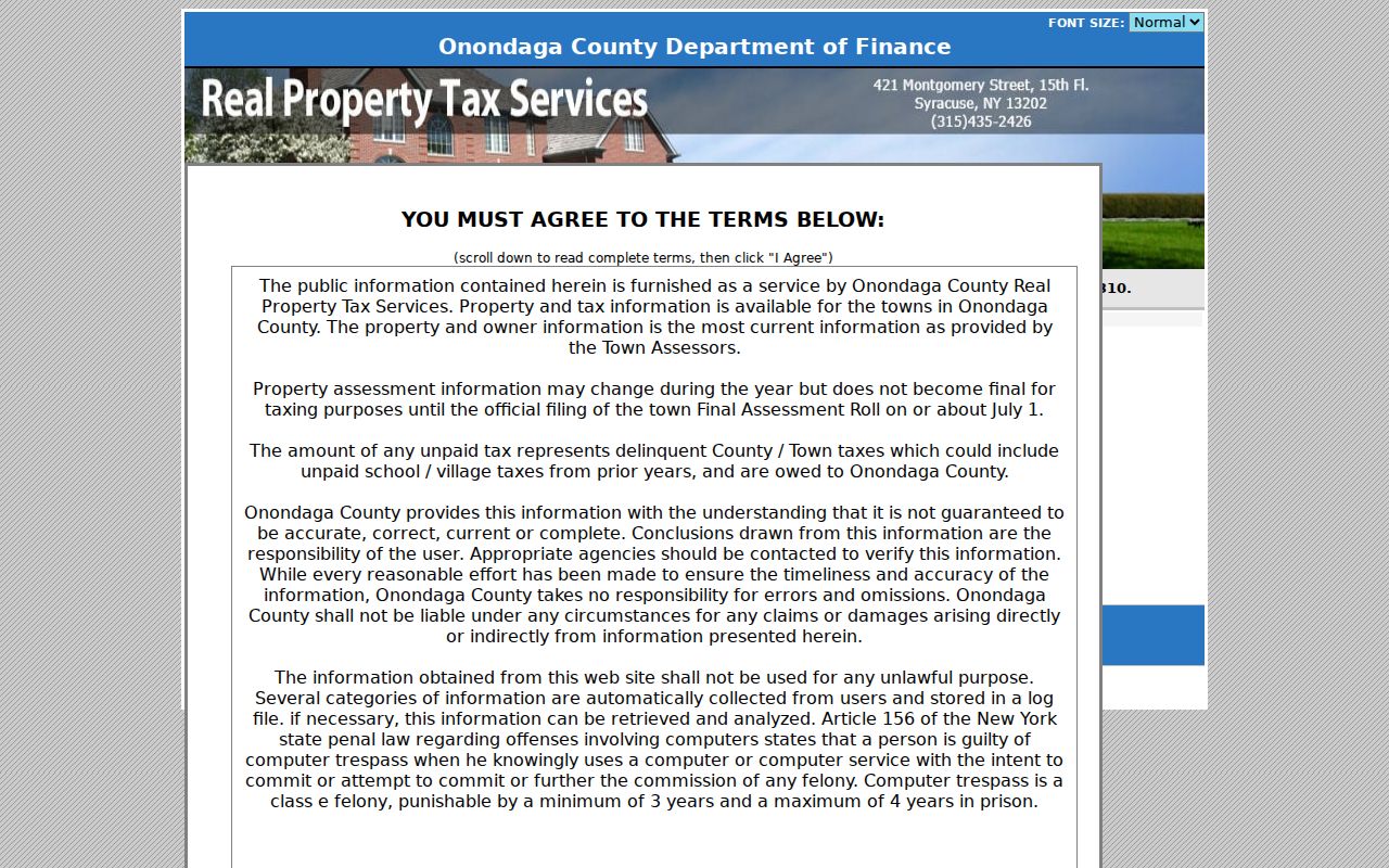
Property, mailing, owner, and tax-map searches begin from the same portal. Re-run a street with the property mode when studying situs, and use mailing mode only when the owner-address side of the roll is the point of comparison.
Note: A Go2Gov result is current assessment information, not proof that every person connected to an address lives there.
Salina Street GIS Parcels
The county GIS is the map stage of an address search. Its basic criteria accept Owner Name, Address, and Parcel ID, with partial strings accepted. Advanced criteria include land-use type, property class, and acreage. A search can cover all municipalities or one selected municipality, and results appear in a data panel with a count. After locating an address, use map clicks for nearby parcels and the Buffer control for a chosen distance, units, and target.
The viewer also offers address finding, distance and area measurement, PDF export, CSV export, and layers for parcels, land use, ZIP boundaries, flood context, districts, and planning information. Some layers appear only at particular zoom levels. A buffer captures map proximity, not a legal adjacency finding or a shared household. The GIS disclaimer also says parcel lines are public-record map data, not survey evidence or legal boundary proof.
County Planning 911 Address Administration approves street names and assigns numbers in most towns. For a numbering or street-name question, contact County Planning Address Administration at 315-435-2611 or addressing@ongov.net. No verified Salina-wide renumbering or renaming year was found, so an old and current address should be tested through parcels, plats, and directory years instead of assuming a documented change.
Salina Street Address Keys
One 2025 final-roll example illustrates why four address labels must remain separate. Parcel 027.-05-07.0 lists 821 Vine St as Property Location, a tax description of Liverpool Manor #1 Lt 19, Liverpool school district, and 416 Schaffer Ave, Syracuse NY 13206 as Current Owner's Address. That owner address is not the situs and neither label proves occupancy. The parcel number and legal description are often more durable than a street-name search when a record uses a subdivision or lot reference.
- Parcel or tax-map number
- A county assessment identifier for a mapped property. Copy punctuation exactly when using it as the link between assessment and map records.
- Situs address
- The physical property location shown on the assessment roll. It can differ from an owner's current address.
- Plat
- A recorded map that can show lots, blocks, or subdivision relationships. County subdivision and tract maps reach back to 1799.
- Criss-cross directory
- An address-organized directory section, when a volume has one, used to find a dated printed entry by street rather than by name.
Salina Street Directory Deed Trail
For title history along a Salina street, search the current assessment owner as a grantee in Cott, then use the latest deed to identify the grantor, legal description, recording reference, and any document number or book and page shown. Search that seller as an earlier grantee and continue until the chain changes description, leaves the online index, or needs a counter record. If a street address is absent, switch to the tax-map parcel, lot and block, subdivision name, or legal description.
The Cott guest index is free to search. Viewing or printing many document images requires an account or subscription. The research records a $5 24-hour option, $100 for 30 days, and $500 for 180 days, with printing at $0.65 per page plus listed card charges. Some entries have no image, and confidential images are not displayed. County land records begin in 1794; published digitization scope includes mortgage paper from 1794 to 1950 and deed and mortgage numerical indices from 1799 to 1986, while exact image availability varies by entry.
The County's Cott access screen separates the free index from account-based image access. The screenshot below is a reminder to record whether a finding is index-only or image-available before drawing conclusions from it.
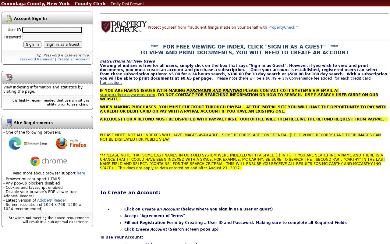
Older material may need the Clerk's counter, photostat, microfilm, or archives route. The Onondaga County Clerk's mortgages and deeds division is the custodian route, and the real-property line is 315-435-8250.
For names with spaces, Cott's old-name instructions say a historic entry such as MC CARTHY may require a contains search for CARTHY. Cott says that quirk does not apply to data on or after August 21, 2017. Retain the spelling that produced a result.
Salina Street Voter Limits
The public voter locator is person-centered. It uses County, last name, first name, date of birth, and ZIP prompts, with address information referenced in its instructions. Select Onondaga County and use the exact identity details available. A no-match is not proof that a person moved, never registered, or is not connected to an address. Spelling, county, status, incomplete input, and protected records can all affect a result.
Election Law §3-220 keeps registration records under Board of Elections supervision and withholds driver-license, non-driver ID, and Social Security number information. The public lookup does not provide a confirmed whole-street list. A fuller voter-file request follows the Board of Elections' written process and requires an elections-purpose certification, so it is not a shortcut to a street roster.
Note: A registered-voter result is a limited election record, not a complete list of people at a Salina street address.
Salina Street Directory History
Historical street work belongs at OCPL Central Local History and Genealogy, not in a modern parcel result alone. The collection lists Syracuse city directories from 1844 to the present with gaps, including microfiche from 1844 to 1860, microfilm from 1862 to 1935, and paper volumes from 1936 forward. Telephone books run from 1894 to the present. Ask staff for a specified year and address, because a separate public criss-cross year range was not published.
The OCPL additional sources collection also identifies newspapers, tax rolls, maps and atlases, cemetery records, church records, WPA files, and microfilm. A printed directory entry is a dated publication lead. It does not establish current title. For a deeper historical shelf, the Salina city directory collections page focuses on the library's directory runs and how an entry should be read.
Salina Address Record Options
Address-keyed sources overlap without becoming the same record. Use the access channel that matches the question, and keep the source's field names intact. The table distinguishes a property-location lead from an owner-address lead and a printed historical address from a title document.
| Address key | Salina record | Access channel | What it can support |
|---|---|---|---|
| Situs | Assessment roll, GIS, Planning request | Go2Gov, map viewer, phone or FOIL | Parcel, owner field, map context, and possible retained work record |
| Owner address | Assessment roll | Go2Gov mailing mode or final-roll PDF | Current owner's listed address, which can differ from situs |
| Legal description | Deed, mortgage, plat | Cott, Clerk counter, or archives | Title trail and lot, block, tract, or subdivision link |
| Street segment | GIS parcels | Map click, browse, buffer, or export if enabled | Nearby parcel and district context, not legal adjacency |
| Historical street | Directories and telephone books | OCPL in-room and selected digital access | Dated printed address entry, subject to gaps and omissions |
| Permit address | Planning or code file | No public index found; phone or focused FOIL | Construction or alteration evidence if retained |
Salina Planning and Code has no verified public permit or code-case index. Call Planning at 315-451-0492 with an address and narrow date range, or send a focused request under New York FOIL to the responsible Records Access Officer. FOIL generally requires a grant, denial, or acknowledgment within five business days and allows standard paper-copy charges up to $0.25 per page.
Salina Street Postal Labels
Postal labels are a records-geography issue in Salina. Liverpool, Mattydale, Syracuse, Lyncourt, and North Syracuse can appear in the same research trail without establishing the municipal jurisdiction. A physical parcel can carry a different postal city from an owner's correspondence address, and a school-district label is another separate field. For a current delivery result, use the USPS ZIP Code Lookup; for town jurisdiction, compare the assessment parcel, GIS municipality context, and legal description.
The 821 Vine St example combines a Salina situs, a Syracuse owner address, a Liverpool school district, and a Liverpool Manor tax description. Keeping those fields separate makes a Salina street directory search more useful for family history, an estate matter, or verifying a property-related notice. It also prevents a postal city from being mistaken for a town boundary.
Salina Street Directory Limits
A street search cannot reveal a complete household, utility customer data, DMV addresses, confidential-voter actual addresses, sealed files, or everyone who receives mail at a property. Assessment records identify recorded ownership and tax fields. Deeds record legal transactions. Directories preserve what a publisher printed at a particular time. Missing information is not a negative fact about a person or address.
Lawful use. Salina address records are for personal, lawful research and civic record checking. Do not use a public address or record to stalk, harass, threaten, or intimidate anyone; New York Penal Law §120.45 addresses stalking conduct without a legitimate purpose.